17 April 2010

Home Day

As I wasn’t one hundred percent sure of the official end to the Cumbria Way (my guide book said it was Market Cross, but the maps – both OS and Harveys – said it was at the castle.), after checking out, I left Poppy in the car (as she was still a bit stiff) and walked back to the city centre and then walked the route to the castle, so I could say I had done both routes.  A bit sad I know, but I didn’t want anyone to say I hadn’t finished it properly! 

Carlisle Castle
Returning to the car, I drove to Rickerby Park for a quick walk with Poppy and headed for the M6 and the 360 miles home at around 11am.  The journey was uneventful, thankfully, and I arrived home late afternoon.

Memorial Bridge, Rickerby Park
I had certainly started the week with a certain amount of trepidation about walking 80 odd miles by myself, but in reality, with Pops for company it had turned out to be a wonderful adventure.  I am sure the dry weather helped (just a couple of spots of drizzle at the top of Stake Pass on day 3), but I would certainly be happy to repeat the experience on another long distance path.  Completing such paths in one go, walking from place to place is definitely the way to do it – it feels like a journey, and with nothing else to occupy your days you can really become immersed in the experience.  Just do it!

16 April 2010

Day 6 - Caldbeck to Carlisle (16.2 miles)

The day again dawned with glorious blue skies, but with that welcome nip in the air that makes walking a pleasure.  I set out for my last day’s walking at around 9.15am, and immediately had a bit of trouble finding my way out of Caldbeck.  I think I could have taken a much more direct route through the village, but I tried to follow the route as shown on the OS map, and I got rather disorientated.  Anyway, I soon found the village green with its large pond and headed east, alongside Cald Beck, where I met three young and very cute lambs in a small pen at the side of the path.


Colourful cottages, Caldbeck


Spring lambs - Aaarhh!
A short time after entering Parsons Park Wood, the route climbed quite steeply before levelling out.  Poppy spotted a deer crashing through the trees, but fortunately she was on the lead – I didn’t want to lose her at this stage of the walk!  After crossing a couple of fields, the bridleway headed into woods again.
 
View back to Carrock Fell and High Pike


The 'crucial point' on the footpath, where I had a moment of indecision

The book describes a ‘crucial point’ where you had to look for a ‘difficult to spot’ junction.  Unfortunately, this point seems to have been moved from where it is shown on the map, so I was a little unsure of the route for a while, as my GPS told me I hadn’t gone far enough.  I backtracked a couple of hundred meters to the junction and took the correct path, which descended quite steeply to the river, and continued alongside the babbling water on a rocky path.  As I left the cover of trees again, to skirt a large field, the route swung northwards once again to reach a lane. 


Rocky path by River Caldew


Poppy plays 'queen of the castle'
A steepish path up the side of a field took me to a track leading to Sebergham church.  We had a quick stop here and I gave Poppy a drink.  It was quite warm, and whilst away from the river, there wasn’t as much ground water around today.  I headed north along a tarmac track, past Sebergham Hall (which was rather well hidden from view), to reach another lane at Bell Bridge.


Sebergham church


Farmland views
I descended from the road onto the riverside path down a flight of tricky stone steps.  I had to give Poppy a hand too.  From here there was miles of easy walking along the river bank.  After about 2 miles, I stopped for a rest and lay down on a grass bank, with views towards Rose Castle, home to the Bishops of Carlisle since the 13th Century.  The sun was warm on my face, and it was really peaceful.


Cows slake their thirst in the Caldew


Rose Bridge
About ½ mile after Rose Bridge, the CW left the river and headed up a hill.  From the top I looked back for my last lingering view to the distant Lakeland Fells.  Continuing northwards for about a mile, I passed 2 rather grand properties – Lime House School and Hawksdale Hall, before arriving at the village of Bridge End.  The guide book mentioned a petrol station, so I was in half a mind to buy an ice-cream, but unfortunately the garage was now a car showroom, so I had to go without.


Hawksdale Hall


Bishops Mill, Bridge End
After a little road walking (and a little navigation problem) I found the correct route out of Bridge End, past Ellers Mill.  I had now met up again with the River Caldew. Crossing a white bridge (called White Bridge), I reached the village of Dalston, on the busy B5299.  I soon located the Country Kitchen Cafe, run by the lady I had met at the Oddfellow Arms the previous evening, and sat at a pavement table to enjoy a cup of tea and piece of cake.  As the pavement was so hard, I let Poppy lie on my jumper, and she gratefully lay down.  We had now walked about 11 miles today, with just 4 to go to reach Carlisle.


The mill race


White Bridge
The lady (who’s name I have forgotten, sorry) offered to look after Poppy while I used her loo, and then we said our goodbyes.  I decided to buy some food at the bakers opposite to eat back at the B&B latter that evening as I didn’t really fancy heading back out into Carlisle to find somewhere to eat which would allow dogs.


Millenium statue, Dalston


A mature River Caldew
North of Dalston, the CW left the road, and joined up with a cycle path that ran for about 3 ½ km to Cummersdale.  Although it was flat walking, it was not particularly inspiring, particularly at the beginning when it run behind a factory, and the tarmac was hard on the feet.  At least Poppy was able to run free as we were away from any sheep fields.  After a couple of miles I passed under the railway bridge near Cummersdale.  The map shows the route continuing along the cycle path on the western bank of the river, but my guide book describes the route along the eastern bank. As I was a bit fed up with the tarmac by now, I elected to go for the eastern route which followed a narrow path adjacent to fields in which cows were grazing.


Weir at Denton Holme


Empty gas tower, Carlisle - almost beautiful?
Eventually I reached the outskirts of Carlisle and left the river bank to walk on the pavements alongside busy roads to reach the center of town.  There was a lot of traffic about, and, near the bridge over the railway, it was a bit galling to find I had to walk several hundred meters the wrong way down a street to reach a safe crossing point!  A little weary, I finally reached Market Square – in the pedestrianised shopping centre.  There were loads of people about, and I asked a women to take my photo by the finish point.  MISSION ACCOMPLISHED.


Mission accomplished - Market Square, Carlisle

I walked wearily to my B&B and pretty much collapsed for the rest of the evening.  I was very tired, and my back was aching quite badly. I think it was the mileage on hard surfaces that was the problem today.  The room was lovely (probably the nicest of the whole trip), and was a very large single, in the eaves of the house, so it had lovely sloping ceilings.  The bathroom, which was on the landing, had a nice big shower too.  The only two drawbacks were a) it was on the third floor (bad for tired legs) and b) the room was to the front of the property, so overlooked the busy road, which was very noisy.  When trying to get to sleep I had no choice to close the window, as the traffic was still rushing past at gone .


Howard Lodge, Carlisle

I had a shower and identified my photos, then ate my pasty.  Poppy had a well earned sleep.  A little later in the evening I found my way to Rickerby Park to give Poppy a last walkies.  She was amazingly lively and kept running round like a lunatic.  I have no idea where she found the energy – I was pooped!  I think she may have overdone it a bit thought, because the next morning she was a bit stiff and rather reluctant to go down the 3 flights of stairs.


15 April 2010

Day 5 - Keswick to Caldbeck (15.2 miles)

The owners of Larry’s Lodge did not like guests to leave dogs in the room unattended, so Poppy accompanied me to breakfast this morning.  When Anne booked the accommodation, she was told that we would have to stagger our breakfasts as we had no car to leave the dogs in.  Now, with Anne absent, it was either take Poppy to breakfast or leave her in the room.  The owners chose the former – fortunately there were no other guests.

Skiddaw topped with cloud
There was a fair bit of cloud in the sky when we left, and it was quite cold again, but the forecast was for continuing dry weather.  As I was going to climb to the highest point on the CW today, I had opted to take a warmer coat, although within a mile of so of leaving Keswick, I was wondering it I had made a mistake as I was already getting a bit warm.

"Alas, poor Yorrick"
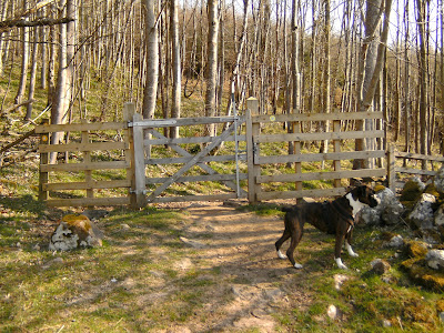
The map shows the CW following roads out of the town, but I took the route as described in my guide book, which runs across Fitz Park.  Poppy got into a bit of trouble with a Staffie, when she tried to join in with a game of football between the dog and two young men.

Crossing the A66, north of Keswick
I left Keswick by turning down the track called Spoony Green Lane, at which point I stopped to take off some layers.  This track passes over the A66 and then reaches the foot of Latrigg where it climbs, initially steeply and then more gently, on a bridleway to a rough lane.  Turning right, I soon reached a car park, already half full – hikers making an early morning assault on Skiddaw.

Noticeboard in Latrigg Woods

View NW to Dodd and Bassenthwaite Lake
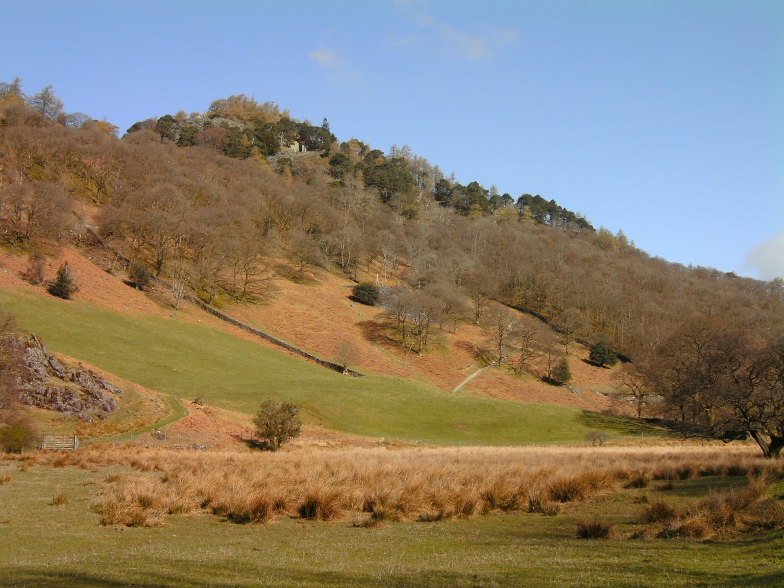
My route only followed the Skiddaw path for a short distance and then descended gently to cross Whit Beck, before swinging east and then north again round the lower slopes of Lonscale Fell.  The views to the south east and west were quite splendid.  I was now on a path half way up the steep sided valley of Glenderaterra Beck.  Across the beck was the back, softer side of Blencathra – no sign of crags and lofty arêtes here.

Descending to Whit Beck (note snaking Skiddaw path on left)


Looking back to Glenderaterra Beck & Blease Fell
I continued on the gently undulating path above the beck for about two miles, before veering NW to rendezvous with Skiddaw House, a rather isolated youth hostel in the virtually treeless Skiddaw Forest.  At this point the CW splits and there is a choice of routes.  I chose to turn NE over the ‘high’ route – the other is an alternative lower level option for inclement weather.

Approaching Skiddaw House (youth hostel)

Time to choose - we went right (the High Route)
Talking of the weather, quite a wind had got up and I was starting to be grateful for the warmer coat.  The clouds had won over the blue sky now, and it was all looking a bit bleak as I headed around the sometimes boggy lower slopes of Great Calva and Coombe Height for about 3.5miles
Infant River Caldew

Looking NE up the valley towards Carrock Fell
Although I had passed quite a few people on the stretch from Whit Beck to Skiddaw House, I was totally on my own on this section (barring Pops, of course), and I think it was the only time of the entire trip when I felt a bit isolated and lonely.  I’m sure it would have been a different story if the sun had been out.  It was therefore with a little relief that I could see cars parked ahead, where the track met a road leading to Mosedale.  There were a number of intrepid teenagers in wet suits on some kind of outward bound course, frolicking in the freezing water. – rather them than me! 

A quick breather before tackling the climb up Grainsgill Beck

View to our next destination - Lingy Hut on the hill top
The CW now made a sharp turn, almost west, to begin the climb up to the highest point on the trail.  Initially there was a stony track, but this petered out at the Carrock Mine workings.  There then followed a tricky and tiring climb on a boggy, rough path alongside Grainsgill Beck.  At least I was sheltered from the wind here.  At one point, as I attempted to cross a streamlet flowing across my path, my boot slipped on some slippery rock and I very nearly fell in.  Out of the wind, I was quite warm by the time I reached the top of the gill.

Carrock Mine workings

Looking back to Mosedale from near the top of Grainsgill
I was relieved to reach the top of the slope, but as I emerged from the protection of the gill, the wind hit me again and it turned quite cold again. I even considered putting my warm hat on.  Swinging roughly north again, I continued to climb gently and soon found a snow pocket, much to Poppy’s delight.  We had seen evidence of snow on the high fells from day one of our walk, but this was the first and only time we got high enough to actually find any. 

Poppy enjoys a snow pocket on Great Lingy Hill
It was a relief to reach Lingy Hut, a former grouse shooting box and now a hiker’s bothy.  I arrived at the same time as a young guy travelling from the other direction. The hut is now a basic shelter, and we chatted for 10 minutes or so out of the cold wind, while we both ate a snack.  He had been wild camping for several weeks on very little money and had originally been accompanied by a friend, who had had to drop out some days earlier with foot problems.  He had not realised the shelter was here and had just had an uncomfortable lunch about 200m away over the ridge, where he had cooked and eaten some noodles in the bitter wind!


Approaching Lingy Hut

Whilst resting in the hut, we were also joined by a New Zealand guy, who was also walking the CW with tent.  They made me feel a bit of a sissy with my little backpack and nice comfy B&Bs at the end of each day!  He had missed the turning up to Lingy Hut and had accidentally walked a mile down the valley to Mosedale before realising his mistake.  I was very glad that my few navigation problems had been very minor.
Murky view east towards the snow capped Pennines

After leaving the hut, the route continued to climb gently for a little over 1km.  It then veered left to climb more steeply up the slope of High Pike, which at 2157ft is the highest point on the CW.  From the summit were rather murky views both east (to snow capped Pennines) and west, across the Solway Firth to Scotland.  At the summit I met another chap doing the CW with his dog, a little Jack Russell.  Like the young lad in the shelter, he too had originally had a walking companion (this time, his daughter), but she dropped out after day two with huge blisters.   We took each others pictures on the summit for prosperity and then I left him on the summit and proceeded to descend off the edge of the Lakeland Fells.  To the north the land fell away sharply to a gentler, pastoral landscape.
On top of High Pike - the highest point on the CW

The quad bike tracks that led me astray off High Pike

Distracted by the view, I followed the obvious track on the ground rather than look at the map or follow the GPS, and suddenly realised that I was heading NE instead of N.  The paths I had been following were apparently quad bike tracks – the actual CW route is barely visible.  Annoyed that I hadn’t read the map properly, I was soon back on track after a little walk cross-country.  Fortunately, at this time of the year, there wasn’t much vegetation to get in my way.
View N over Caldbeck towards the Solway Firth and Scotland beyond

Stone barn at Nether Row

Nearly 3km after leaving the summit of High Pike, I arrived in the hamlet of Nether Row.  From here, the route continued north along tiny lanes for about 1.5km.  At some point the chap with the Jack Russell caught me up again and I let him go on past.  There was then just a short walk across a couple of fields to reach the outskirts of Caldbeck village.  We did have to cross a rather difficult stile here, and as I struggled to help Poppy across it, I enviously recall seeing the Jack Russell man lifting his dog up and tucking it under his arm as he tackled the same obstacle a minute or so earlier!
Looking back to High Pike

Waymarker on the outskirts of Caldbeck

Caldbeck village itself was extremely pretty, and despite my fatigue, I wandered round a little and took some photos before retiring to The Oddfellow Arms.  After a drink in the bar, I headed to my room for the now normal routine of a shower followed by photo identification.  Although Anne had booked us a table in the restaurant, I chose instead to eat in the bar so that Poppy could accompany me.  She was pretty tired, although she had clearly found the colder day much more to her liking, as evidenced by her playful mood at the snow pocket on Great Lingy Hill, and again on the top of High Pike, where she wanted to play tug with her lead., and slept at my feet.  She was within a few feet of three (also tired out) Border Terriers but didn’t bat an eyelid at them.
The Old Smithy tea room, Caldbeck

Oddfellow Arms, Caldbeck

As the bar eating area was rather small, I had to cadge a seat at another couple’s table.  We got talking and when I said that I would be walking to Carlisle the next day, the woman told me that she owned a tea shop in Dalston, a village through which I would be passing about 11 miles into my walk.  I told her I would definitely pop in for a cup of tea and a piece of cake. After dinner, I took Poppy for a last walk around the village before having another early night.  It hit me that tomorrow would be my last day.  I was enjoying this adventure – I really did not want it to end!


14 April 2010

Day 4 - Rosthwaite to Keswick (9.3 miles)

After the lovely evening meal the previous night, the breakfast was quite modest.  Actually; it was a perfectly adequate helping, just much smaller than I had been getting up until now!  I could easily have eaten it all myself, but Poppy was now getting used to me returning to the room with some meaty offering, so I kindly resisted temptation and saved her a bit of sausage.


Looking north up Borrowdale

Today was effectively a rest day, with a relatively short distance to cover.  The sun was making another appearance this morning too, and Borrowdale looked much cheerier than the previous afternoon when I arrived.  It was pretty chilly though, even though I delayed setting off until nearly .

Poppy avoids getting her feet wet
I headed west out of the village to reach the River Derwent, Most dogs would have walked through the shallow water, but Poppy doesn’t much care for getting her feet wet, so she followed me over the stepping stones.  Turning north, the path roughly followed the river for a little over a mile, through Hows Wood and along the back of Castle Crag.  It was on this undulating path that I put my hand in my trouser pocket and discovered I had ‘stolen’ my room key from The Royal Oak.  I did not want to retrace my steps, so I decided to wait until I got to Keswick to ring them.  I could always post the keys back to them from there.

Looking back along the boulder path by River Derwent

Castle Crag from 'the back'
Knowing I didn’t have many miles to cover today I was bimbling along slowly, but I soon reached the beautiful Gowder Dub, a shallow, rocky area on the River Derwent.  Wainright was not wrong referring to this area as “the loveliest square mile in Lakeland”.

Footbridge, Gowder Dub

Looking north up the River Derwent
Approaching Grange, the CW veered left around the village and past Hollows Farm instead.  I then followed the road for about 600m before heading for Derwent Water.  The area here clearly gets very boggy, and there were a number of broadwalks constructed from recycled plastic.   I sauntered along in the sunshine, through Manesty Park and Brandlehow wood, keeping to the paths closest to the lake.  I did let Poppy off the lead along here briefly. 

Leaving the Grange road, the path heads for Derwent Water


View across Derwent Water towards Blencathra

I had intended to stop a while by the lake to read, but even though the sky was virtually cloudless, there was a really chilly wind, and I gave up after about five minutes.  The views across the lake to snow pockets on Blencathra and Skiddaw were quite stunning.  Just past the Low Brandlehow landing stage the CW headed away from the lake and climbed up to the road near Hawes End Outdoor Centre.  There was a spectacular display of daffodils close by.

Poppy in the hand carving by Derwent Water

Fine show of daffodils by Hawes End Outdoor Centre
Leaving the road, I followed a path through a small wood and across an open area called The Park, where there was quite a gathering of people.  Then it was back into the woods (Overside Wood and Silver Hill) for another kilometre or so.  It is clear from the photo that, despite the good weather, spring was really not very far advanced – the trees were still completely devoid of leaves.
Winter lingers on in Overside Wood

I eventually emerged back on the road again and followed it north to the village of Portinscale. Here I stopped for, if my memory serves me correctly, an ice-cream (or was it a cup of tea?)  Leaving the village, I crossed the suspension bridge and followed a (fairly busy) footpath to Keswick. 

Portinscale

Suspension bridge over River Derwent
In town, I headed for the centre, and after wolfing down a tasty pasty, found a seat and phoned the Royal Oak to confess stealing their keys.  I agreed to post them back to them, so bought a jiffy bag for the purpose.  I also bought a couple of post cards and sent one to work and one to Mum & Simon.  Whilst sitting here, I enjoyed a brief ‘Boxer fest’.  Someone turned up with one, and then another couple turned up with two.  We all made a fuss of each others dogs, although Poppy was the prettiest and most nicely marked, of course!

Keswick under Skiddaw
After my late start, and deliberately slow progress, I finally reached Larry’s Lodge B&B around .  I took a shower, identified the day’s photos and had a bit of a read.  This was the first night on the trail when I needed to go out to find something to eat.  When Steve and I visit Keswick we often eat at the Pheasant Inn,
Crosthwaite Road
, and so I had half a mind to go there myself.  I knew they allowed dogs in the bar, but also that the floor was rather hard, so I tucked her bed under my arm and headed across Fitz Park which appeared to be in about the right direction.  For once, my sense of direction was right, and I emerged on
Crosthwaite Road
only about 100m south of the pub, arriving at .

Poppy in Fitz Park, Keswick
Amazingly, even at this relatively early hour, every table in the bar was taken.  As I was not starving hungry (the pasty having helped to take the edge off my appetite), I was happy to wait, and chatted to an older man at the bar who was on holiday alone in the area.  We talked about trail walking and he told me  he had walked the Coast to Coast twice, once many, many years ago, and once more recently with his grandson.  He was one of those really wiry types, with not an ounce of fat on him. Anyway, it passed the time until a table became free after about 30mins.

Larry's Lodge, Keswick

After my meal (including a sticky toffee pudding, which I definitely should NOT have eaten!), I woke Poppy up and walked back across the park in the fading light to the B&B.   I watched a bit of TV and took Pops out one more time before going to sleep, although this did involve a half mile round trip to find the nearest bit of grass.